VAJRON AI Inspection Drone

Autonomous missions, 360° obstacle sensing and a 30× zoom camera.

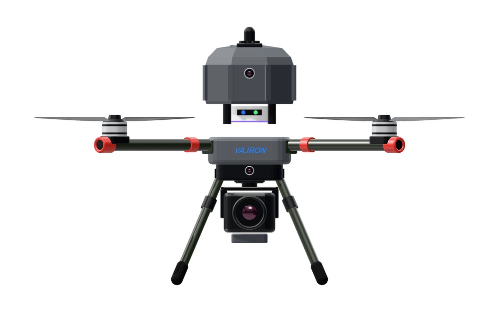
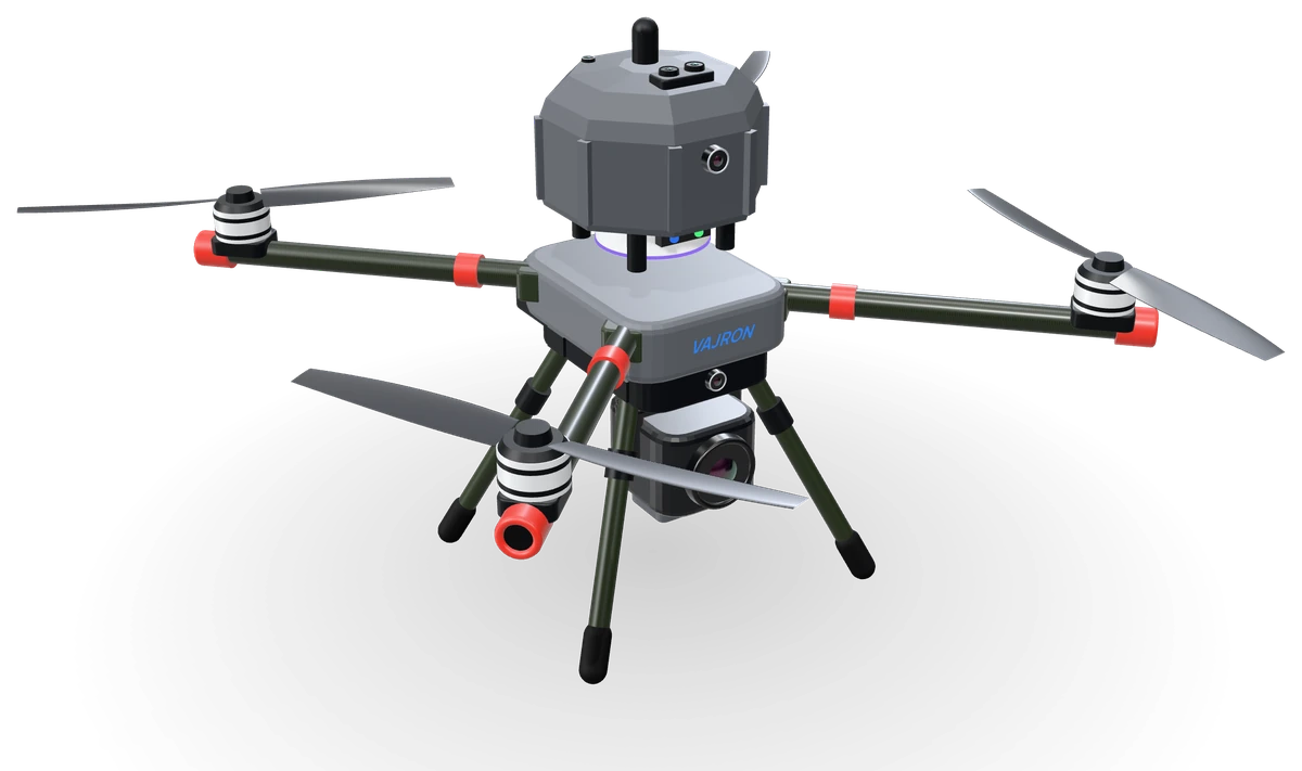
VAJRON AI Inspection Drone at three-quarters from the front: faceted sensor dome with the RTK mast, grey body with the VAJRON mark, four carbon rotor arms with red end caps, a 3-axis gimbal camera and landing gear.
Optical zoom
30×
LiDAR obstacle sensing
360°
Forward vision field
120°
RTK positioning
cmlevel
AI monitoring accuracy
95%+
Battery exchange
<2min

Product film

System by system

A rendered walk-around of the aircraft's imaging, sensing, navigation and power systems.

00

Aircraft

Autonomous quadrotor with a modular carbon-fibre airframe.

Rendered product film. Tap a chapter to jump to it.

General arrangement

One airframe, six integrated subsystems

A modular carbon-fibre quadrotor carrying its perception, navigation and imaging systems on a single structure.

Front elevation of the VAJRON AI Inspection Drone showing the RTK navigation mast, upper sensor housing, four rotor arms, gimbal camera and landing gear.

Internal: NVIDIA Jetson edge computer, 4G datalink, protected battery tray with BMS.

Front elevation, product render. Not to scale.

Perception

Vision and LiDAR, fused on board

360° LiDARForward, upward and downward sensingOnboard fusion

Omnidirectional LiDAR

360°· 15 m radius

Obstacle detection all the way around the aircraft.

Forward vision

120°FOV

Wide-angle forward obstacle sensing.

Upward LiDAR

500Hz · 0.2–20 m

Overhead ranging in flight; 40 m clearance scan before take-off.

Downward LiDAR

mmlevel AGL

Height above ground for precision landing and terrain following.

Sensor fusion

The YOLO vision model identifies what an object is; 2D LiDAR measures how far away it is. Both are fused on the edge computer for real-time avoidance.

Also on board

Upward wide-angle vision camera, and temperature and humidity sensors that feed the take-off weather checks.

Sensing performance

Detection envelope

Coverage of the obstacle-sensing suite in plan and elevation.

Plan view

Horizontal
Plan view of horizontal sensor coverage The omnidirectional LiDAR covers a full 360 degree circle of 15 metres radius around the aircraft. The forward wide-angle vision sensor covers a 120 degree field ahead of the aircraft. 120° FOV 51015 m FWD 360° LiDAR detection radius 15 m
Rings every 5 m. The forward field shows angle only; a range for the forward vision sensor is not published.

Elevation

Vertical
Elevation view of vertical sensor coverage Before take-off, top-mounted LiDAR and camera scan a 40 metre overhead clearance zone. In flight, the upward safety LiDAR samples at 500 hertz over 0.2 to 20 metres. The downward precision LiDAR measures height above ground to millimetre level. 010203040 m Overhead clearance scan 40 m, before take-off Upward LiDAR 0.2–20 m, 500 Hz Downward LiDAR mm-level AGL
Vertical scale applies above the aircraft. Height above ground is not drawn to scale.
Omnidirectional LiDAR radius
15m
Forward vision field of view
120°
Upward LiDAR sampling rate
500Hz
Upward LiDAR range
0.2–20m
Pre-take-off overhead scan
40m
RTK positioning accuracy
cmlevel
Landing precision (downward LiDAR)
mmlevel
AI monitoring accuracy
95%+

Payload

3-axis stabilised AI camera

30× optical zoom4K UHD3-axis stabilisation

Imaging payload

Inspect from a safe stand-off distance

Continuous optical zoom
30×
Sensor resolution
4KUHD
Stabilisation
3axis
  • Active gimbal compensates for vibration and wind
  • Real-time target lock
  • Object tracking and classification on the onboard NVIDIA Jetson
  • Stand-off inspection without flying close to the subject

Avionics

Navigation, computing and safety on the aircraft

RTK GNSSNVIDIA Jetson4G linkTake-off interlocks

RTK GNSS

cmlevel

GPS, GLONASS, Galileo and BeiDou, with differential corrections from a ground base. Repeatable waypoints, near-zero drift.
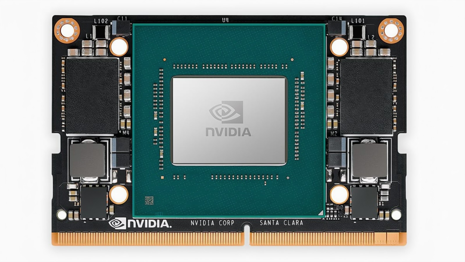
NVIDIA Jetson module, the aircraft's onboard edge computer.

Edge computer

NVIDIAJetson

Live video analytics on the aircraft. Trained on 100,000+ images, 95%+ monitoring accuracy.

4G communications

A Linux-based SIM dongle on the edge computer streams results to the mobile application and ground station while the aircraft is still flying.

  • Live results
  • Detection feed
  • Manual RTL

System architecture

Data flow on the aircraft and to the ground segment

VAJRON AI Inspection Drone system architecture On the aircraft, perception sensors and the gimbal camera feed an onboard NVIDIA Jetson edge computer, which provides obstacle data to flight control and sends results to the communications link. RTK GNSS navigation, corrected by a ground base station, feeds flight control. The 4G link serves the mobile application and the ground control station. A protected battery tray with battery management supplies all subsystems. AIRCRAFT GROUND SEGMENT PERCEPTIONEDGE COMPUTECOMMUNICATIONS PAYLOADFLIGHT CONTROLNAVIGATION POWER CONTROL STATIONMOBILE APPLICATIONRTK BASE STATION 360° LiDAR, 15 mForward vision, 120° Upward and downward LiDARTemperature, humidity NVIDIA Jetson, onboardYOLO and LiDAR fusion Live video analyticsObstacle mapping 4G, SIM dongle on theedge computerLive results to ground 3-axis stabilised camera30× optical zoom4K UHD sensor Redundant avionicsAutonomous mission, RTL Take-off interlocksObstacle avoidance RTK GNSS, cm-levelGPS, GLONASSGalileo, BeiDou Protected battery tray, IP54 · BMS with cell balancing · Real-time voltage telemetry · Exchange under 2 min Live trackingDetection feed, manual RTL Monitoring, alertsReports, flight records Differential correctionsIndustrial-height stand correctionsfeed 4Gpower bus VAJRON AI Inspection Drone system architecture Perception sensors and the gimbal camera feed the onboard NVIDIA Jetson edge computer. The edge computer sends results to the 4G communications link and obstacle data to flight control. RTK navigation, corrected by the ground base station, feeds flight control. The 4G link serves the ground control station and the mobile application. The protected battery tray supplies all subsystems. AIRCRAFT GROUND SEGMENT PERCEPTIONPAYLOADEDGE COMPUTE COMMUNICATIONSFLIGHT CONTROL POWERNAVIGATION CONTROLMOBILE APPRTK BASE 360° LiDAR, 15 mForward vision, 120°Up and down LiDARTemperature, humidity 3-axis stabilised30× optical zoom4K UHD sensor NVIDIA Jetson, onboardYOLO and LiDAR fusionLive video analyticsObstacle mapping 4G, SIM dongle onthe edge computerLive results to ground Redundant avionicsAutonomous mission, RTLTake-off interlocksObstacle avoidance Protected tray, IP54BMS, cell balancingExchange under 2 min RTK GNSS, cm-levelGPS, GLONASSGalileo, BeiDou Live trackingDetection feedManual RTL MonitoringAlerts, reportsFlight records DifferentialcorrectionsIndustrial stand power buscorrections4G feed

Autonomous mission sequence

  1. Pre-flight verificationHealth, calibration, battery and environment checks before arming.
  2. Safe take-offOverhead clearance confirmed by the 40 m scan; gear retracts after lift-off.
  3. Obstacle-aware flightTerrain-aware path planning with fused vision and LiDAR, and dynamic safety buffers around moving people or vehicles.
  4. Autonomous returnSmart return-to-launch triggers automatically if battery or conditions change mid-mission.

Safety interlocks

  • Overhead obstacle lockTake-off blocked
  • Forced take-off interventionEvasive ascent
  • Unsafe locationTake-off denied
  • Live rain detectionTake-off denied
  • Forecast rain or humidityWarning on station
  • Network weather unavailableOnboard sensor backup
  • Low battery or weather changeAutomatic RTL
  • Operator overrideManual RTL

Power

Protected battery, quick exchange

Battery enclosure
IP54
Battery exchange
<2min
Management
BMS
  • Integrated charging and battery management
  • Cell balancing and real-time voltage telemetry
  • Quick-swap tray keeps turnaround short between missions

Ground segment

Aircraft, station and base

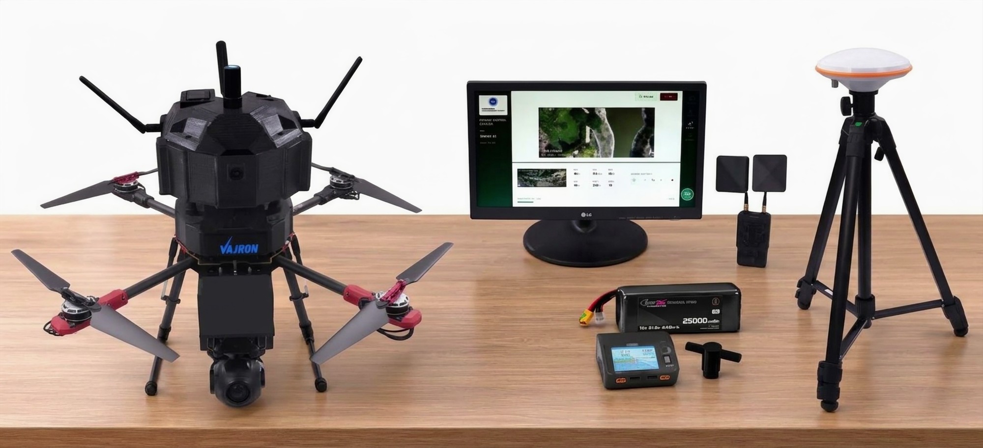
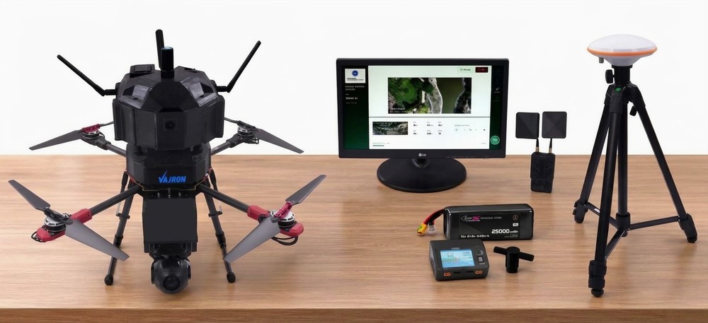
System kit on a table: the VAJRON aircraft, a ground station display, an RTK base antenna on a tripod, a battery and charger.
System kit: aircraft, ground station, RTK base station and battery set.

Ground control station

Live tracking, the live video detection feed and emergency manual return-to-launch.

RTK base station

Field-deployable base antennas on an industrial-height stand, supplying differential corrections.

Mobile application

Live monitoring over 4G, weather and mission alerts, downloadable reports and flight records, with encrypted officials-only access.

Applications

Configured for inspection and site monitoring

Mission profiles supported by the aircraft's imaging, sensing and navigation systems.

Infrastructure inspection

Stand-off visual inspection of structures, pathways, gates and public facilities using the 30× optical zoom.

  • 30× camera
  • Obstacle sensing

Site surveillance and security

Encroachment detection, unsafe-tree identification and blind-spot coverage, with live detection feeds to the station and app.

  • Edge AI
  • 4G link

Mapping and asset inventory

RTK-held repeatable flight paths, with geo-tagged locations for trees, benches, bins, light poles and play equipment.

  • RTK GNSS
  • Geo-tagging

Vegetation and irrigation

Green cover, canopy, plant health and water stress, and detection of dry zones, waterlogging and leaks.

  • 4K camera
  • Edge AI

Water-body monitoring

Observation of water level, algal growth and floating waste.

  • 30× camera
  • Edge AI

Change detection

Month-on-month comparison of repeat surveys, and verification of completed works against geo-tagged records.

  • RTK repeatability
  • Edge AI

Technical specifications

VAJRON AI Inspection Drone datasheet

Values as published by VAJRON Global Tech.

01Airframe

ConfigurationQuadrotor
StructureModular, carbon fibre
AvionicsRedundant
Landing gearRetractable, automated. Retracts after take-off, deploys before landing
Camera clearanceGear clear of the camera field of view in flight

02Power

Battery enclosureProtected tray, IP54 rated
Exchange time< 2 min, quick-swap
ManagementIntegrated charging and BMS
MonitoringCell balancing, real-time voltage telemetry

03Navigation

PositioningRTK GNSS
AccuracyCentimetre-level
ConstellationsGPS, GLONASS, Galileo, BeiDou
CorrectionsDifferential, from RTK ground base
WaypointsRepeatable execution, near-zero drift

04Perception

Omnidirectional LiDAR360° horizontal, 15 m radius
Forward visionWide-angle, 120° FOV
Upward LiDAR500 Hz, 0.2–20 m
Upward visionWide-angle camera
Overhead scan40 m clearance zone before take-off
Downward LiDARMillimetre-level AGL and landing precision
EnvironmentalTemperature and humidity sensors

05Payload

Type3-axis stabilised AI camera
Optical zoom30× continuous
Sensor4K Ultra HD
StabilisationActive gimbal, compensates vibration and wind
TrackingReal-time target lock

06Edge computing

ProcessorNVIDIA Jetson, onboard
ProcessingLive video analytics on the aircraft
Sensor fusionYOLO vision with 2D LiDAR
Training set100,000+ images
Monitoring accuracy95%+

07Communications

Cellular4G, Linux-based SIM dongle on the edge computer
Live resultsStreamed to mobile application in flight
Ground stationLive video detection feed, emergency manual RTL

08Operations and safety

OperationOne-button autonomous mission
Pre-flightAutomatic calibration, battery and readiness checks
Take-off interlocksOverhead obstacle lock; unsafe-location denial
Weather4G forecast check; live-rain take-off denial; onboard sensor backup
ReturnSmart RTL on low battery or weather change

09Ground segment

Control stationLive tracking, detection feed, monitor support
RTK baseBase antennas on industrial-height stand
Mobile applicationLive monitoring, alerts, downloadable reports, flight records
Data securityEncrypted, officials-only access
VAJRON Global Tech Pvt. Ltd.Specifications subject to change without notice.

Contact

Technical briefings and demonstrations

For system briefings, flight demonstrations and the complete datasheet, contact VAJRON Global Tech.
Manufacturer
VAJRON Global Tech Pvt. Ltd.
Product
VAJRON AI Inspection Drone
Web
www.vajronglobaltech.com
Email and phone
info@vajronglobaltech.com · +91 98188 05137